Tuesday, March 17, 2009

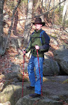
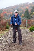
Proco Staffers in the Great Outdoors


"Climb the mountains and get their good tidings!" ~ John Muir

This is a video Emily and I recorded from the summit of Stone Mountain in Elkin County, NC. February, 2009.

Monday, March 16, 2009

Mount Rogers Backpacking Adventure... Blue Ridge Style!

This video was taken in July, 2008, at Grayson Highlands, VA. On this particular trip, my former coworkers from Blue Ridge Mountain Sports and I undertook a 12 mile traverse across rolling plains, rocky trails, and wilderness streams. Our destination: Mount Rogers, the tallest mountain in Virginia!


On our way, we encountered dozens of wild ponies, a notable trademark of Mount Rogers. One pony, in particular, grabbed our interest. Straight out of the 80's with his long, flowing mane, we dubbed him the Bon Jovi horse. Later, that pony would outsmart and humiliate us by reaching the top of the mountain first. How this majestic, four-legged beast of the wilderness managed to accomplish this, we never did learn...


After a desparate search for water (which ended well, thanks to a good Samaritan..."Dat map is wrong! The water be over dere!") we made camp and constructed the most epic camp fire in existence! But not before watching the sunset from Rhodedendron Gap...


After making it through a chilly night with little more than my survival blanket (it is surprisingly cold on the top of a mountain, even in July...) I awoke thirsty and craving hydration, as did my compatriots, so we left camp to purify water. Upon our return, we discovered our campsite invaded by wild ponies. Curious, backpack-sniffing, wild ponies.


Thank you, Mount Rogers, for an epic time in the foothills of Virginia.


Piedmont Vistas: Day Hiking in the Sauratown Mountains


Part II


Now that you've tackled Jomeokee, the Great Pilot, and seen the white cliffs standing silently over the Piedmont Plateau and the raptors soaring around Big Pinnacle, it is time to venture northeast to Hanging Rock State Park, home to Moore's Knob, Cooks Wall, and Hanging Rock, the tallest peaks in the Sauratown Mountain Range.

When I first moved to Winston-Salem, Hanging Rock fast became my initial impression of the North Carolina mountains. Since my first day hike there with friends, Erica and Sarah, I have returned several times to explore the different trails and witness the Piedmont's seasonal evolution. With trails of varying length and difficulty, plus plenty of opportunities for camping, it is the ideal park for family getaways.

The Hanging Rock Trail is easily accessed from the visitor center parking lot and is 2.2 miles, out and back. It is a steep and strenuous climb but well-maintained and worth the effort. In the summer, Hanging Rock is shrouded in haze. At 2,070 feet, even this jagged rock face cannot escape the southern humidity. But it was encouraging to find hikers scrambling up the trail, regardless! A lot can be said for a cool mountain breeze after a tiring ascent.

I returned in November, hoping to catch the sunset from Moore's Knob, where an impressive, stone observation tower looms above the tree line. Sitting at 2,579 feet, Moore's Knob is the tallest point in the Sauratown Mountains. The Moore's Wall Loop Trail can be found at the second parking lot, just beyond the visitor center. On their way up, visitors will witness outstanding rock structures, such as Indian Face and Balanced Rock. From the summit, hikers can see Hanging Rock to the east, and to the west, Pilot Mountain, a faint bump on the cusp of the horizon.

When my old college buddies, Sherwin, Matt, and Robbie, came to visit this past January, Hanging Rock State Park once again seemed a good place to explore. We embarked down the Cooks Wall Trail, encountering dozens of fellow hikers with their dogs and stopping on our way at House Rock, a flat ledge with views to the southeast, and Cooks Wall, a popular spot for climbers. Shortly after, we arrived at Devil's Chimney, where sunshine radiated through the clouds like the glow of Heaven. From this exposed rock face, Winston-Salem is visible on a clear day.

My most recent day hike in the Sauratown Mountains took me back to the summit of Hanging Rock, this time, with my good friend, Tim Bob. It was an especially frigid morning, and the parking lot was nearly deserted. From the summit, the Piedmont Plateau looked bare, radically different from its lush appearance in August. And rather than having to endure humidity, we were forced to take cover from cold mountain gusts strong enough to blow us over. Yet, despite the landscape's transformative nature, the Sauratown Mountains remain a testament to the strength of these lands and the power of nature and heritage. The seasons may come and go, but the mountains will always remain.

To see this article on the Great Outdoor Provision Co. Blog, in addition to other articles about the outdoor lifestyle, follow this link...

Piedmont Vistas: Day Hiking in the Sauratown Mountains


Part I

You've been itching to get outside all week; the weather has been unbelievable, and your hiking boots in the corner of your closet are collecting more dust than mountain dirt. You've got to go hiking! But time is precious, and there aren't enough hours in the day. The Appalachians are too far, you think. Maybe next weekend... Fortunately, for those in Winston-Salem and surrounding cities, Pilot Mountain and Hanging Rock State Parks are within close driving distance, so there's no excuse for delaying that day hike!

As a native of Virginia with a brief track record in North Carolina, I have much exploring still ahead of me; but so far, Pilot Mountain and Hanging Rock have provided several fun-filled days in the outdoors.

Pilot Mountain, located between Pinnacle and Mount Airy, NC, towers 2,421 feet tall. It is a giant monadnock amongst a heritage-rich landscape and part of the Sauratown Mountain Range. On a clear day, it can be seen miles away, incoming on Route 52 out of Winston. I first visited "Jomeokee," as the Saura Indians once called it, in October, 2008. While visitors are more than welcome to park at Little Pinnacle Overlook and forego the arduous climb, my friend Jennie and I attempted the Grindstone Trail, which takes hikers from the bottom up with a 500-foot plus elevation gain in under two miles. On this breezy October day, the trees were painted red, orange, and yellow, and as we neared the summit, the tree line thinned to reveal an expansive view of azure skies and vibrant countryside. Immense, white cliffs border the Ledge Spring Trail, which forms a loop with the Grindstone, taking hikers to the overlook. There, visitors are presented with a clear view of Big Pinnacle (Pilot Mountain), home to raptors and ravens.

Jomeokee Trail leads hikers down and around the knob-shaped mountain, but climbing the steep rock walls that make Pilot such a unique monolith is forbidden to ensure the survival of the birds inhabiting it. However, rock climbers frequent the aforementioned cliffs along Ledge Spring Trail. Jennie and I traversed the Jomeokee Trail, awed by Pilot's bold presence, and assailed by legions of lady bugs, a sign - I am told - of good fortune. And if my first visit to Pilot Mountain is any indication, you better believe I'll be back in the spring.

To see this article on the Great Outdoor Provision Co. website, among other articles, click this link...